


 .
.
 Niagara Falls is composed of two major sections separated by Goat Island: Horseshoe Falls, on the Canadian side of the border and American Falls on the United States side. The smaller Bridal Veil Falls also is located on the American side, separated from the main falls by Luna Island. Niagara Falls were formed when glaciers receded at the end of the Wisconsin glaciation (the last ice age), and water from the newly-formed Great Lakes carved a path through the Niagara Escarpment en route to the Atlantic Ocean.
 While not exceptionally high, the Niagara Falls are very wide. More than six million cubic feet (168,000 m³) of water falls over the crest line every minute in high flow, and almost 4 million cubic feet (110,000 m³) on average. It is the most powerful waterfall in North America.
 The Niagara Falls are renowned both for their beauty and as a valuable source of hydroelectric power. Managing the balance between recreational, commercial, and industrial uses has been a challenge for the stewards of the falls since the 1800s
 Peak numbers of visitors occur in the summertime, when Niagara Falls are both a daytime and evening attraction. From the Canadian side, floodlights illuminate both sides of the Falls for several hours after dark (until midnight). The number of visitors in 2008 is expected to total 20 million and by 2009, the annual rate is expected to top 28 million tourists a year. The oldest and best known tourist attraction at Niagara Falls is the Maid of the Mist boat cruise, named for an ancient Ongiara Indian mythical character, which has carried passengers into the whirlpools beneath the Falls since 1846. Cruise boats operate from boat docks on both sides of the falls
 American side
 The Niagara Scenic Trolley offers guided trips along the American Falls and around Goat Island. Panoramic and aerial views of the falls can also be viewed from the Flight of Angels helium balloon ride, or by helicopter. The Niagara Gorge Discovery Center showcases the natural and local history of Niagara Falls and the Niagara Gorge. A casino and luxury hotel was opened in Niagara Falls, New York, by the Seneca Indian tribe. The Seneca Niagara Casino occupies the former Niagara Falls Convention Center. The new hotel is the first addition to the city's skyline since completion of the United Way office building in the twenties.
 Canadian side

 The Whirlpool Aero Car, built in 1916 from a design by Spanish engineer Leonardo Torres y Quevedo, is a cable car which takes passengers over the whirlpool on the Canadian side. The Journey Behind the Falls - accessible by elevators from the street level entrance - consists of an observation platform and series of tunnels near the bottom of the Horseshoe Falls on the Canadian side.
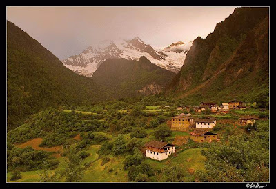
 The Himalaya stretch across five nations — Pakistan, India, China, Bhutan and Nepal. It is the source of two of the world's major river systems — the Indus Basin and the Ganga-Brahmaputra Basin. An estimated 750 million people live in the watershed area of the Himalayan rivers, which also includes Bangladesh.
 The Himalayan (pronounced as Himaalayas and not with a short "a" as is commonly mispronounced)range runs for about 2400 km, from Nanga Parbat in the west to Namche Barwa in the east. The width varies between 250-300 km. The Himalayan range comprises three parallel ranges, arranged by elevation and geological age.
 The Himalayan range at Yumesongdong in Sikkim, in the Yumthang River valley.


 Yumthang Valley in Sikkim
 Gurudogmar Lake, with the Gurudogmar peaks in the backdrop


